A Description of the Empire of China and Chinese-Tartary, Together with the Kingdoms of Korea and Tibet: Containing the Geography and History (Natural as Well as Civil) of Those Countries


A Description of the Empire of China and Chinese-Tartary, Together with the Kingdoms of Korea and Tibet: Containing the Geography and History (Natural as Well as Civil) of Those Countries
[001490] Du Halde, P. J. B.; Green, ? And Guthrie, William (Trans.) A Description of the Empire of China and Chinese-Tartary, Together with the Kingdoms of Korea and Tibet: Containing the Geography and History (Natural as Well as Civil) of Those Countries. London: T. Gardner for Edward Cave, 1738. First Thus. Folio. Hardback. Good+ Three volumes complete, 1738-1741 - Volume One, [5], ii-viii, [1], ii-xi, [4], 2-678pp (with pages 125-6 and 139-40 omitted); Volume Two, [5], 2-388pp, [8] (with pages 46-49 duplicated and the second page 48 mispaginated as 52, pages 229-236 duplicated and 237-244 omitted) and Volume Three, maps and plans. Uniformly bound in full panelled calf, raised bands, spines in seven panels, title label to second panel, author/volume label to third, remaining panels gilt with central floral spray lozenge and volute corner pieces, covers with rolled panel design and gilt roll to edges
Rebacked and recornered, with a few minor repairs to covers, but quite attractive. Internally several signatures are lightly browned, a few examples of spotting, but generally clean. Armorial bookplate of George William Mason to front pastedowns and another previous owners name in ink to head of titles
Specific faults; volume one, Sss1 has a small brown mark to text (not affecting sense), 4Q has a few brown spots to text but again does not affect sense; volume two, a brown spot to 4Y1 and 4Z2 (not affecting sense, and a small hole to 5D1 catching a few letters, but with no loss of sense; volume three, maps all reguarded, quite a large closed tear to head of large map coloured in outline, small amount of loss to margin, several of the maps have recent small professional repairs with Japanese tissue, a couple with older paper repairs, a few tiny nicks and tears, one or two worm holes, two maps remargined, and one, the ninth sheet of the Tibet map, has a stain running down the length and is silked to reverse
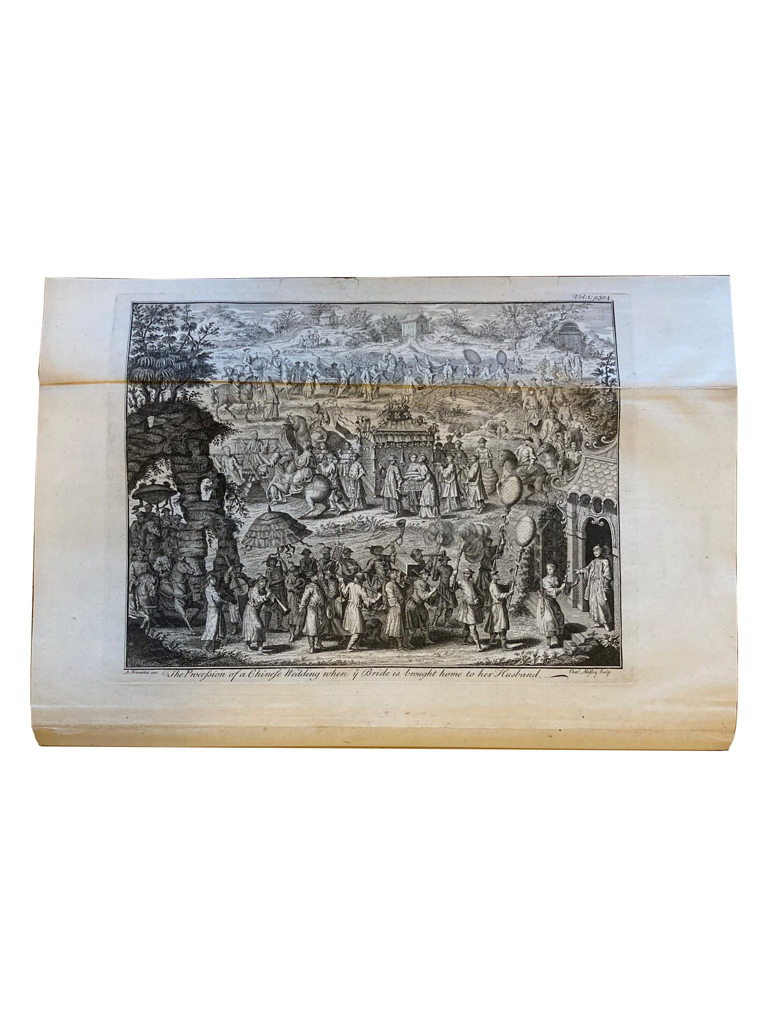
Complete with sixty-four maps, plans and plates, frontispiece of Confucius to volume one, and sixty-three bound in the third volume (one coloured in outline, thirty-nine folding, twenty-one full page, one folding plate and one double page plate). Maps and plates by a variety of engravers and artists including Bowen, Seale, Moore, Basire and Fletcher
The first complete English translation of Du Halde's magnum opus, first published in French in 1735, and previously published in an abridged English edition by John Watts in 1736. This edition "excelled the version published by Watts" (Lowendahl). The general map of Tibet called for at the end of volume two was never issued in this edition and the work is complete despite the occasionally erratic pagination. Du Halde was a French Jesuit who never actually visited China, but based his work on information obtained from Jesuit missionaries
Lowendahl 409
RELATED ITEMS


 A Description of the Empire of China and Chinese-Tartary, Together with the Kingdoms of Korea and Tibet: Containing the Geography and History (Natural as Well as Civil) of Those Countries. London: T. Gardner for Edward Cave, 1738. First Thus. Folio. Hardback. Good+ Three volumes complete, 1738-1741 - Volume One, [5], ii-viii, [1], ii-xi, [4], 2-678pp (with pages 125-6 and 139-40 omitted); Volume Two, [5], 2-388pp, [8] (with pages 46-49 duplicated and the second page 48 mispaginated as 52, pages 229-236 duplicated and 237-244 omitted) and Volume Three, maps and plans. Uniformly bound in full panelled calf, raised bands, spines in seven panels, title label to second panel, author/volume label to third, remaining panels gilt with central floral spray lozenge and volute corner pieces, covers with rolled panel design and gilt roll to edgesRebacked and recornered, with a few minor repairs to covers, but quite attractive. Internally several signatures are lightly browned, a few examples of spotting, but generally clean. Armorial bookplate of George William Mason to front pastedowns and another previous owners name in ink to head of titlesSpecific faults; volume one, Sss1 has a small brown mark to text (not affecting sense), 4Q has a few brown spots to text but again does not affect sense; volume two, a brown spot to 4Y1 and 4Z2 (not affecting sense, and a small hole to 5D1 catching a few letters, but with no loss of sense; volume three, maps all reguarded, quite a large closed tear to head of large map coloured in outline, small amount of loss to margin, several of the maps have recent small professional repairs with Japanese tissue, a couple with older paper repairs, a few tiny nicks and tears, one or two worm holes, two maps remargined, and one, the ninth sheet of the Tibet map, has a stain running down the length and is silked to reverse Complete with sixty-four maps, plans and plates, frontispiece of Confucius to volume one, and sixty-three bound in the third volume (one coloured in outline, thirty-nine folding, twenty-one full page, one folding plate and one double page plate). Maps and plates by a variety of engravers and artists including Bowen, Seale, Moore, Basire and FletcherThe first complete English translation of Du Halde's magnum opus, first published in French in 1735, and previously published in an abridged English edition by John Watts in 1736. This edition "excelled the version published by Watts" (Lowendahl). The general map of Tibet called for at the end of volume two was never issued in this edition and the work is complete despite the occasionally erratic pagination. Du Halde was a French Jesuit who never actually visited China, but based his work on information obtained from Jesuit missionaries Lowendahl 409 )